Winnipeg to Reykjavík Flight Time, Distance, Route Map
Flight time from Winnipeg, Canada to Reykjavík, Iceland is 5 hours 36 minutes under avarage conditions. Our flight time calculator assumes an average flight speed for a commercial airliner of 500 mph, which is equivalent to 805 km/hr or 434 knots. Actual flight times may vary depending on aircraft type, cruise speed, routing, weather conditions, passenger load, and other factors.
What is the Flight Distance Between Winnipeg and Reykjavík?
The flight distance from Winnipeg (Canada) to Reykjavík (Iceland) is 2804 miles. This is equivalent to 4513 kilometers or 2435 nautical miles. The calculated distance (air line) is the straight line distance or direct flight distance between cities. The nearest airport to Winnipeg, is Winnipeg James Armstrong Richardson International Airport (YWG) and the nearest airport to Reykjavík, is Reykjavik Domestic Airport (RKV).
Winnipeg - Reykjavík Timezones & Time Difference
Current local time in Winnipeg is 2025-04-17, 21:58:42 CDT
Current local time in Reykjavík is 2025-04-18, 02:58:42 GMT.
Time difference between Winnipeg (Canada) and Reykjavík (Iceland) is 5 Hours.
Reykjavík time is 5 Hours ahead of Winnipeg.
Winnipeg to Reykjavík Flight Route Map
Flight map from Winnipeg, Canada to Reykjavík, Iceland is given below.Click the map to view Winnipeg to Reykjavík nonstop flight path and travel direction.
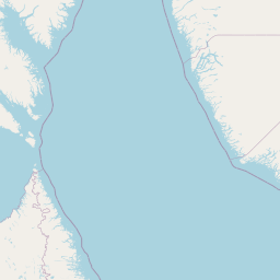             Leaflet | © OpenStreetMap The distance between cities calculated based on their latitudes and longitudes. This is also called distance as the crow flies. Bird flight distance is calculated by drawing a straight line between two point coordinates. The length of this drawn line will give the shortest distance value. This distance may be very much different from the actual travel distance. Winnipeg GPS Coordinates: Latitude: N 49° 53' 59.1'' Longitude: W 97° 8' 15'' Reykjavík GPS Coordinates: Latitude: N 64° 7' 35.5'' Longitude: W 21° 49' 2.8'' Winnipeg Map, Where is Winnipeg located? Reykjavík Map, Where is Reykjavík located? |
Popular Searches from Winnipeg
- Winnipeg to Vancouver flight time, duration and distance
- Winnipeg to London flight time, duration and distance
- Winnipeg to Vancouver flight time, duration and distance
- Winnipeg to London flight time, duration and distance
- Winnipeg to St. John's flight time, duration and distance
- Winnipeg to San Diego flight time, duration and distance
- Winnipeg to Charlottetown flight time, duration and distance
- Winnipeg to Santiago de Compostela flight time, duration and distance
- Winnipeg to Porto flight time, duration and distance
- Winnipeg to London flight time, duration and distance
- Winnipeg to Fargo flight time, duration and distance
- Winnipeg to Denver flight time, duration and distance
- Winnipeg to Minneapolis flight time, duration and distance
- Winnipeg to Saskatoon flight time, duration and distance
- Winnipeg to Montreal flight time, duration and distance
- Winnipeg to Calgary flight time, duration and distance
- Winnipeg to Alert flight time, duration and distance
- Winnipeg to Lynn Lake flight time, duration and distance
- Winnipeg to St. John's flight time, duration and distance
Popular Searches from Reykjavík
- Reykjavík to Sydney flight time, duration and distance
- Reykjavík to Ushuaia flight time, duration and distance
- Reykjavík to Rome flight time, duration and distance
- Reykjavík to Prestwick flight time, duration and distance
- Reykjavík to Los Angeles flight time, duration and distance
- Reykjavík to Waterbury flight time, duration and distance
- Reykjavík to Chicago flight time, duration and distance
- Reykjavík to Sisimiut flight time, duration and distance
- Reykjavík to Halifax flight time, duration and distance
- Reykjavík to Black Tickle flight time, duration and distance
- Reykjavík to Newfoundland flight time, duration and distance
- Reykjavík to Glasgow flight time, duration and distance
- Reykjavík to Vladivostok flight time, duration and distance
- Reykjavík to Wellington flight time, duration and distance
- Reykjavík to Canberra flight time, duration and distance
- Reykjavík to Wellington flight time, duration and distance
- Reykjavík to Johannesburg flight time, duration and distance
- Reykjavík to La Réunion flight time, duration and distance
- Reykjavík to Kuala Lumpur flight time, duration and distance
- Reykjavík to Toronto flight time, duration and distance