Auckland to Cairns Flight Time, Distance, Route Map
Flight time from Auckland, New Zealand to Cairns, Australia is 4 hours 29 minutes under avarage conditions. Our flight time calculator assumes an average flight speed for a commercial airliner of 500 mph, which is equivalent to 805 km/hr or 434 knots. Actual flight times may vary depending on aircraft type, cruise speed, routing, weather conditions, passenger load, and other factors.
What is the Flight Distance Between Auckland and Cairns?
The flight distance from Auckland (New Zealand) to Cairns (Australia) is 2240 miles. This is equivalent to 3605 kilometers or 1945 nautical miles. The calculated distance (air line) is the straight line distance or direct flight distance between cities. The nearest airport to Auckland, is Auckland International Airport (AKL) and the nearest airport to Cairns, is Cairns Airport (CNS).
Auckland - Cairns Timezones & Time Difference
Current local time in Auckland is 2025-05-13, 03:55:12 NZST
Current local time in Cairns is 2025-05-13, 01:55:12 AEST.
Time difference between Auckland (New Zealand) and Cairns (Australia) is 2 Hours.
Cairns time is 2 Hours behind Auckland.
Auckland to Cairns Flight Route Map
Flight map from Auckland, New Zealand to Cairns, Australia is given below.Click the map to view Auckland to Cairns nonstop flight path and travel direction.
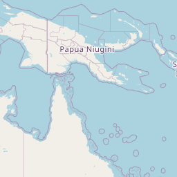 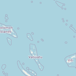 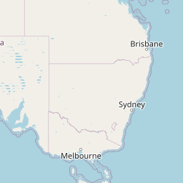 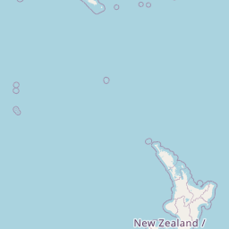 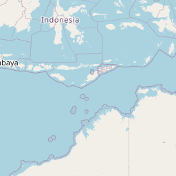     Leaflet | © OpenStreetMap The distance between cities calculated based on their latitudes and longitudes. This is also called distance as the crow flies. Bird flight distance is calculated by drawing a straight line between two point coordinates. The length of this drawn line will give the shortest distance value. This distance may be very much different from the actual travel distance. Auckland GPS Coordinates: Latitude: S 36° 50' 54.5'' Longitude: E 174° 45' 48'' Cairns GPS Coordinates: Latitude: S 16° 55' 13.2'' Longitude: E 145° 46' 15.1'' Auckland Map, Where is Auckland located? Cairns Map, Where is Cairns located? |
Popular Searches from Auckland
- Auckland to Honolulu flight time, duration and distance
- Auckland to Brisbane flight time, duration and distance
- Auckland to Adelaide flight time, duration and distance
- Auckland to Lusaka flight time, duration and distance
- Auckland to Sydney flight time, duration and distance
- Auckland to Honolulu flight time, duration and distance
- Auckland to San Francisco flight time, duration and distance
- Auckland to Oslo flight time, duration and distance
- Auckland to Tokyo flight time, duration and distance
- Auckland to Los Angeles flight time, duration and distance
- Auckland to Tokyo flight time, duration and distance
- Auckland to Brasília flight time, duration and distance
- Auckland to Miami flight time, duration and distance
- Auckland to Miami flight time, duration and distance
- Auckland to Singapore flight time, duration and distance
- Auckland to Dubai flight time, duration and distance
- Auckland to Doha flight time, duration and distance
- Auckland to Santiago flight time, duration and distance
- Auckland to Sydney flight time, duration and distance
Popular Searches from Cairns
- Cairns to Sydney flight time, duration and distance
- Cairns to Christchurch flight time, duration and distance
- Cairns to Sydney flight time, duration and distance
- Cairns to Perth flight time, duration and distance
- Cairns to Brisbane flight time, duration and distance
- Cairns to Perth flight time, duration and distance
- Cairns to Brisbane flight time, duration and distance
- Cairns to Krong Siem Reap flight time, duration and distance
- Cairns to Tokyo flight time, duration and distance
- Cairns to Auckland flight time, duration and distance
- Cairns to Sydney flight time, duration and distance
- Cairns to Sydney flight time, duration and distance
- Cairns to Perth flight time, duration and distance
- Cairns to Alice Springs flight time, duration and distance
- Cairns to Sydney flight time, duration and distance
- Cairns to Denpasar flight time, duration and distance
- Cairns to Tokyo flight time, duration and distance
- Cairns to Perth flight time, duration and distance
- Cairns to Port Moresby flight time, duration and distance
- Cairns to Manchester flight time, duration and distance