Denver to Bozeman Flight Time, Distance, Route Map
Flight time from Denver, United States to Bozeman, United States is 1 hours 1 minutes under avarage conditions. Our flight time calculator assumes an average flight speed for a commercial airliner of 500 mph, which is equivalent to 805 km/hr or 434 knots. Actual flight times may vary depending on aircraft type, cruise speed, routing, weather conditions, passenger load, and other factors.
What is the Flight Distance Between Denver and Bozeman?
The flight distance from Denver (United States) to Bozeman (United States) is 513 miles. This is equivalent to 825 kilometers or 445 nautical miles. The calculated distance (air line) is the straight line distance or direct flight distance between cities. The nearest airport to Denver, is Buckley Air National Guard Base (BFK) and the nearest airport to Bozeman, is Gallatin Field (BZN).
Denver - Bozeman Timezones & Time Difference
Current local time in Denver is 2025-05-18, 01:03:37 MDT
Current local time in Bozeman is 2025-05-18, 01:03:37 MDT.
Time difference between Denver (United States) and Bozeman (United States) is 0 Hours.
Denver to Bozeman Flight Route Map
Flight map from Denver, United States to Bozeman, United States is given below.Click the map to view Denver to Bozeman nonstop flight path and travel direction.
   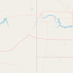                Leaflet | © OpenStreetMap The distance between cities calculated based on their latitudes and longitudes. This is also called distance as the crow flies. Bird flight distance is calculated by drawing a straight line between two point coordinates. The length of this drawn line will give the shortest distance value. This distance may be very much different from the actual travel distance. Denver GPS Coordinates: Latitude: N 39° 44' 21.2'' Longitude: W 104° 59' 24.9'' Bozeman GPS Coordinates: Latitude: N 45° 40' 37.2'' Longitude: W 111° 2' 34.6'' Denver Map, Where is Denver located? Bozeman Map, Where is Bozeman located? |
Popular Searches from Denver
- Denver to Honolulu flight time, duration and distance
- Denver to Ontario flight time, duration and distance
- Denver to Pensacola flight time, duration and distance
- Denver to Aspen flight time, duration and distance
- Denver to Phoenix flight time, duration and distance
- Denver to Newark flight time, duration and distance
- Denver to Charlotte Amalie flight time, duration and distance
- Denver to St. Louis flight time, duration and distance
- Denver to Pensacola flight time, duration and distance
- Denver to Dubai flight time, duration and distance
- Denver to Santa Fe flight time, duration and distance
- Denver to Paris flight time, duration and distance
- Denver to Miami flight time, duration and distance
- Denver to Portland flight time, duration and distance
- Denver to Orlando flight time, duration and distance
- Denver to Miami flight time, duration and distance
- Denver to Vancouver flight time, duration and distance
Popular Searches from Bozeman
- Bozeman to San Juan flight time, duration and distance
- Bozeman to Seattle flight time, duration and distance
- Bozeman to Washington flight time, duration and distance
- Bozeman to Las Vegas flight time, duration and distance
- Bozeman to Salt Lake City flight time, duration and distance
- Bozeman to Guangzhou flight time, duration and distance
- Bozeman to Los Angeles flight time, duration and distance
- Bozeman to Lisbon flight time, duration and distance
- Bozeman to Loreto flight time, duration and distance
- Bozeman to Provo flight time, duration and distance
- Bozeman to Salt Lake City flight time, duration and distance
- Bozeman to Scottsdale flight time, duration and distance
- Bozeman to Las Vegas flight time, duration and distance
- Bozeman to Lisbon flight time, duration and distance
- Bozeman to Denver flight time, duration and distance
- Bozeman to New York flight time, duration and distance
- Bozeman to Salt Lake City flight time, duration and distance
- Bozeman to Athens flight time, duration and distance
- Bozeman to Minneapolis flight time, duration and distance
- Bozeman to Newark flight time, duration and distance