Denver to Rapid City Flight Time, Distance, Route Map
Flight time from Denver, United States to Rapid City, United States is 0 hours 37 minutes under avarage conditions. Our flight time calculator assumes an average flight speed for a commercial airliner of 500 mph, which is equivalent to 805 km/hr or 434 knots. Actual flight times may vary depending on aircraft type, cruise speed, routing, weather conditions, passenger load, and other factors.
What is the Flight Distance Between Denver and Rapid City?
The flight distance from Denver (United States) to Rapid City (United States) is 314 miles. This is equivalent to 505 kilometers or 273 nautical miles. The calculated distance (air line) is the straight line distance or direct flight distance between cities. The nearest airport to Denver, is Buckley Air National Guard Base (BFK) and the nearest airport to Rapid City, is Ellsworth Air Force Base (RCA).
Denver - Rapid City Timezones & Time Difference
Current local time in Denver is 2025-04-13, 09:34:41 MDT
Current local time in Rapid City is 2025-04-13, 10:34:41 CDT.
Time difference between Denver (United States) and Rapid City (United States) is 1 Hours.
Rapid City time is 1 Hours ahead of Denver.
Denver to Rapid City Flight Route Map
Flight map from Denver, United States to Rapid City, United States is given below.Click the map to view Denver to Rapid City nonstop flight path and travel direction.
 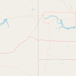               Leaflet | © OpenStreetMap The distance between cities calculated based on their latitudes and longitudes. This is also called distance as the crow flies. Bird flight distance is calculated by drawing a straight line between two point coordinates. The length of this drawn line will give the shortest distance value. This distance may be very much different from the actual travel distance. Denver GPS Coordinates: Latitude: N 39° 44' 21.2'' Longitude: W 104° 59' 24.9'' Rapid City GPS Coordinates: Latitude: N 44° 4' 50'' Longitude: W 103° 13' 51.7'' Denver Map, Where is Denver located? Rapid City Map, Where is Rapid City located? |
Popular Searches from Denver
- Denver to Portland flight time, duration and distance
- Denver to Orlando flight time, duration and distance
- Denver to Miami flight time, duration and distance
- Denver to Vancouver flight time, duration and distance
- Denver to Elgin flight time, duration and distance
- Denver to Newark flight time, duration and distance
- Denver to Honolulu flight time, duration and distance
- Denver to Frankfurt flight time, duration and distance
- Denver to Minneapolis flight time, duration and distance
- Denver to Buenos Aires flight time, duration and distance
- Denver to Rio de Janeiro flight time, duration and distance
- Denver to Dulles flight time, duration and distance
- Denver to Wichita flight time, duration and distance
- Denver to Portland flight time, duration and distance
- Denver to Minneapolis flight time, duration and distance
- Denver to Chicago flight time, duration and distance
- Denver to Idaho Falls flight time, duration and distance
- Denver to Houston flight time, duration and distance
- Denver to Phoenix flight time, duration and distance
Popular Searches from Rapid City
- Rapid City to Minneapolis flight time, duration and distance
- Rapid City to Denver flight time, duration and distance
- Rapid City to Yellowstone National Park flight time, duration and distance
- Rapid City to Mountain Home flight time, duration and distance
- Rapid City to Watertown flight time, duration and distance
- Rapid City to Coeur d'Alene flight time, duration and distance
- Rapid City to Orlando flight time, duration and distance
- Rapid City to Sandusky flight time, duration and distance
- Rapid City to Manila flight time, duration and distance
- Rapid City to Phoenix flight time, duration and distance
- Rapid City to Manila flight time, duration and distance
- Rapid City to Canton flight time, duration and distance
- Rapid City to Mitchell flight time, duration and distance
- Rapid City to West Yellowstone flight time, duration and distance
- Rapid City to Knoxville flight time, duration and distance
- Rapid City to Branson flight time, duration and distance
- Rapid City to Orlando flight time, duration and distance
- Rapid City to Pine River flight time, duration and distance
- Rapid City to Manila flight time, duration and distance