Doha to Durban Flight Time, Distance, Route Map
Flight time from Doha, Qatar to Durban, South Africa is 8 hours 5 minutes under avarage conditions. Our flight time calculator assumes an average flight speed for a commercial airliner of 500 mph, which is equivalent to 805 km/hr or 434 knots. Actual flight times may vary depending on aircraft type, cruise speed, routing, weather conditions, passenger load, and other factors.
What is the Flight Distance Between Doha and Durban?
The flight distance from Doha (Qatar) to Durban (South Africa) is 4046 miles. This is equivalent to 6511 kilometers or 3513 nautical miles. The calculated distance (air line) is the straight line distance or direct flight distance between cities. The nearest airport to Doha, is Doha Airport (DOH) and the nearest airport to Durban, is Virginia Airport (VIR).
Doha - Durban Timezones & Time Difference
Current local time in Doha is 2025-04-28, 01:34:52 +03
Current local time in Durban is 2025-04-28, 00:34:52 SAST.
Time difference between Doha (Qatar) and Durban (South Africa) is 1 Hours.
Durban time is 1 Hours behind Doha.
Doha to Durban Flight Route Map
Flight map from Doha, Qatar to Durban, South Africa is given below.Click the map to view Doha to Durban nonstop flight path and travel direction.
           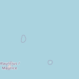        Leaflet | © OpenStreetMap The distance between cities calculated based on their latitudes and longitudes. This is also called distance as the crow flies. Bird flight distance is calculated by drawing a straight line between two point coordinates. The length of this drawn line will give the shortest distance value. This distance may be very much different from the actual travel distance. Doha GPS Coordinates: Latitude: N 25° 17' 29.8'' Longitude: E 51° 31' 49.6'' Durban GPS Coordinates: Latitude: S 29° 51' 31.2'' Longitude: E 31° 1' 18.6'' Doha Map, Where is Doha located? Durban Map, Where is Durban located? |
Popular Searches from Doha
- Doha to Denpasar flight time, duration and distance
- Doha to Zagreb flight time, duration and distance
- Doha to Denpasar flight time, duration and distance
- Doha to Yerevan flight time, duration and distance
- Doha to Amman flight time, duration and distance
- Doha to New York flight time, duration and distance
- Doha to Melbourne flight time, duration and distance
- Doha to Lisbon flight time, duration and distance
- Doha to Hanoi flight time, duration and distance
- Doha to London flight time, duration and distance
- Doha to Chicago flight time, duration and distance
- Doha to Ho Chi Minh City flight time, duration and distance
- Doha to Busuanga flight time, duration and distance
- Doha to Seattle flight time, duration and distance
- Doha to Tokyo flight time, duration and distance
- Doha to Abu Dhabi flight time, duration and distance
- Doha to Souvenir flight time, duration and distance
- Doha to Auckland flight time, duration and distance
- Doha to Colombo flight time, duration and distance
Popular Searches from Durban
- Durban to Johannesburg flight time, duration and distance
- Durban to Tanzania flight time, duration and distance
- Durban to Nouakchott flight time, duration and distance
- Durban to Guangzhou flight time, duration and distance
- Durban to Los Angeles flight time, duration and distance
- Durban to Lisbon flight time, duration and distance
- Durban to Livingstone flight time, duration and distance
- Durban to Brussels flight time, duration and distance
- Durban to Brussels flight time, duration and distance
- Durban to Brazzaville flight time, duration and distance
- Durban to Lisbon flight time, duration and distance
- Durban to Gqeberha flight time, duration and distance
- Durban to Sydney flight time, duration and distance
- Durban to Sydney flight time, duration and distance
- Durban to London flight time, duration and distance
- Durban to Pretoria flight time, duration and distance
- Durban to Pretoria flight time, duration and distance
- Durban to Phuket flight time, duration and distance
- Durban to Perth flight time, duration and distance