Dubai to Kuwait City Flight Time, Distance, Route Map
Flight time from Dubai, United Arab Emirates to Kuwait City, Kuwait is 1 hours 3 minutes under avarage conditions. Our flight time calculator assumes an average flight speed for a commercial airliner of 500 mph, which is equivalent to 805 km/hr or 434 knots. Actual flight times may vary depending on aircraft type, cruise speed, routing, weather conditions, passenger load, and other factors.
What is the Flight Distance Between Dubai and Kuwait City?
The flight distance from Dubai (United Arab Emirates) to Kuwait City (Kuwait) is 533 miles. This is equivalent to 857 kilometers or 463 nautical miles. The calculated distance (air line) is the straight line distance or direct flight distance between cities. The nearest airport to Dubai, is Dubai International Airport (DXB) and the nearest airport to Kuwait City, is Kuwait International Airport (KWI).
Dubai - Kuwait City Timezones & Time Difference
Current local time in Dubai is 2025-05-18, 01:07:46 +04
Current local time in Kuwait City is 2025-05-18, 00:07:46 +03.
Time difference between Dubai (United Arab Emirates) and Kuwait City (Kuwait) is 1 Hours.
Kuwait City time is 1 Hours behind Dubai.
Dubai to Kuwait City Flight Route Map
Flight map from Dubai, United Arab Emirates to Kuwait City, Kuwait is given below.Click the map to view Dubai to Kuwait City nonstop flight path and travel direction.
  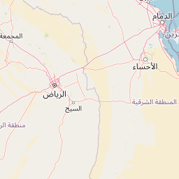 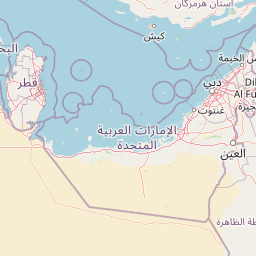   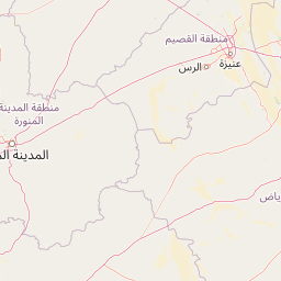 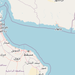   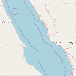   Leaflet | © OpenStreetMap The distance between cities calculated based on their latitudes and longitudes. This is also called distance as the crow flies. Bird flight distance is calculated by drawing a straight line between two point coordinates. The length of this drawn line will give the shortest distance value. This distance may be very much different from the actual travel distance. Dubai GPS Coordinates: Latitude: N 25° 12' 17.5'' Longitude: E 55° 16' 14.8'' Kuwait City GPS Coordinates: Latitude: N 29° 22' 33.1'' Longitude: E 47° 58' 38.7'' Dubai Map, Where is Dubai located? Kuwait City Map, Where is Kuwait City located? |
Popular Searches from Dubai
- Dubai to Washington flight time, duration and distance
- Dubai to London flight time, duration and distance
- Dubai to Frankfurt flight time, duration and distance
- Dubai to San Francisco flight time, duration and distance
- Dubai to Frankfurt flight time, duration and distance
- Dubai to Sydney flight time, duration and distance
- Dubai to Doha flight time, duration and distance
- Dubai to Algiers flight time, duration and distance
- Dubai to Tokyo flight time, duration and distance
- Dubai to Mexico City flight time, duration and distance
- Dubai to Shanghai flight time, duration and distance
- Dubai to Mumbai flight time, duration and distance
- Dubai to Rio de Janeiro flight time, duration and distance
- Dubai to Houston flight time, duration and distance
- Dubai to Sydney flight time, duration and distance
- Dubai to Kolkata flight time, duration and distance
- Dubai to Bangkok flight time, duration and distance
- Dubai to Los Angeles flight time, duration and distance
Popular Searches from Kuwait City
- Kuwait City to Frankfurt flight time, duration and distance
- Kuwait City to Geneva flight time, duration and distance
- Kuwait City to Abu Dhabi flight time, duration and distance
- Kuwait City to Frankfurt flight time, duration and distance
- Kuwait City to El Paso flight time, duration and distance
- Kuwait City to Baiyun flight time, duration and distance
- Kuwait City to Tehran flight time, duration and distance
- Kuwait City to İstanbul flight time, duration and distance
- Kuwait City to Muscat flight time, duration and distance
- Kuwait City to Ramstein-Miesenbach flight time, duration and distance
- Kuwait City to Kuala Lumpur flight time, duration and distance
- Kuwait City to Tokyo flight time, duration and distance
- Kuwait City to Dubai flight time, duration and distance
- Kuwait City to Sydney flight time, duration and distance
- Kuwait City to Doha flight time, duration and distance
- Kuwait City to Doha flight time, duration and distance
- Kuwait City to Balikpapan flight time, duration and distance
- Kuwait City to Tel Aviv-Yafo flight time, duration and distance