Fort Lauderdale to Montreal Flight Time, Distance, Route Map
Flight time from Fort Lauderdale, United States to Montreal, Canada is 2 hours 46 minutes under avarage conditions. Our flight time calculator assumes an average flight speed for a commercial airliner of 500 mph, which is equivalent to 805 km/hr or 434 knots. Actual flight times may vary depending on aircraft type, cruise speed, routing, weather conditions, passenger load, and other factors.
What is the Flight Distance Between Fort Lauderdale and Montreal?
The flight distance from Fort Lauderdale (United States) to Montreal (Canada) is 1388 miles. This is equivalent to 2233 kilometers or 1205 nautical miles. The calculated distance (air line) is the straight line distance or direct flight distance between cities. The nearest airport to Fort Lauderdale, is Ft. Lauderdale International Airport (FLL) and the nearest airport to Montreal, is St. Hubert Airport (YHU).
Fort Lauderdale - Montreal Timezones & Time Difference
Current local time in Fort Lauderdale is 2025-08-02, 13:26:16 EDT
Current local time in Montreal is 2025-08-02, 13:26:16 EDT.
Time difference between Fort Lauderdale (United States) and Montreal (Canada) is 0 Hours.
Fort Lauderdale to Montreal Flight Route Map
Flight map from Fort Lauderdale, United States to Montreal, Canada is given below.Click the map to view Fort Lauderdale to Montreal nonstop flight path and travel direction.
      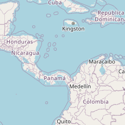             Leaflet | © OpenStreetMap The distance between cities calculated based on their latitudes and longitudes. This is also called distance as the crow flies. Bird flight distance is calculated by drawing a straight line between two point coordinates. The length of this drawn line will give the shortest distance value. This distance may be very much different from the actual travel distance. Fort Lauderdale GPS Coordinates: Latitude: N 26° 7' 20.8'' Longitude: W 80° 8' 14.3'' Montreal GPS Coordinates: Latitude: N 45° 30' 6.1'' Longitude: W 73° 34' 2.1'' Fort Lauderdale Map, Where is Fort Lauderdale located? Montreal Map, Where is Montreal located? |
Popular Searches from Fort Lauderdale
- Fort Lauderdale to Branson flight time, duration and distance
- Fort Lauderdale to Miami Beach flight time, duration and distance
- Fort Lauderdale to Baltimore flight time, duration and distance
- Fort Lauderdale to Chicago flight time, duration and distance
- Fort Lauderdale to Atlanta flight time, duration and distance
- Fort Lauderdale to Atlanta flight time, duration and distance
- Fort Lauderdale to Pensacola flight time, duration and distance
- Fort Lauderdale to Minneapolis flight time, duration and distance
- Fort Lauderdale to Saint Kitts flight time, duration and distance
- Fort Lauderdale to Brazii de Sus flight time, duration and distance
- Fort Lauderdale to Seattle flight time, duration and distance
- Fort Lauderdale to San Francisco flight time, duration and distance
- Fort Lauderdale to Los Angeles flight time, duration and distance
- Fort Lauderdale to Santiago flight time, duration and distance
- Fort Lauderdale to Seoul flight time, duration and distance
- Fort Lauderdale to Ozark flight time, duration and distance
- Fort Lauderdale to Houston flight time, duration and distance
- Fort Lauderdale to Philadelphia flight time, duration and distance
Popular Searches from Montreal
- Montreal to Hong Kong flight time, duration and distance
- Montreal to Frankfurt am Main flight time, duration and distance
- Montreal to Vancouver flight time, duration and distance
- Montreal to Imola flight time, duration and distance
- Montreal to Brisbane flight time, duration and distance
- Montreal to Denver flight time, duration and distance
- Montreal to Rome flight time, duration and distance
- Montreal to Fort Lauderdale flight time, duration and distance
- Montreal to Vancouver flight time, duration and distance
- Montreal to Kansas City flight time, duration and distance
- Montreal to Chicago flight time, duration and distance
- Montreal to Santiago de Querétaro flight time, duration and distance
- Montreal to Tijuana flight time, duration and distance
- Montreal to Paris flight time, duration and distance
- Montreal to Lima flight time, duration and distance
- Montreal to Edmonton flight time, duration and distance
- Montreal to Calgary flight time, duration and distance
- Montreal to Puerto Vallarta flight time, duration and distance
- Montreal to Atlanta flight time, duration and distance