Lima to San Francisco Flight Time, Distance, Route Map
Flight time from Lima, Peru to San Francisco, United States is 9 hours 3 minutes under avarage conditions. Our flight time calculator assumes an average flight speed for a commercial airliner of 500 mph, which is equivalent to 805 km/hr or 434 knots. Actual flight times may vary depending on aircraft type, cruise speed, routing, weather conditions, passenger load, and other factors.
What is the Flight Distance Between Lima and San Francisco?
The flight distance from Lima (Peru) to San Francisco (United States) is 4524 miles. This is equivalent to 7280 kilometers or 3929 nautical miles. The calculated distance (air line) is the straight line distance or direct flight distance between cities. The nearest airport to Lima, is J Chavez International Airport (LIM) and the nearest airport to San Francisco, is SFO International Airport (SFO).
Lima - San Francisco Timezones & Time Difference
Current local time in Lima is 2025-08-02, 12:26:16 -05
Current local time in San Francisco is 2025-08-02, 10:26:16 PDT.
Time difference between Lima (Peru) and San Francisco (United States) is 2 Hours.
San Francisco time is 2 Hours behind Lima.
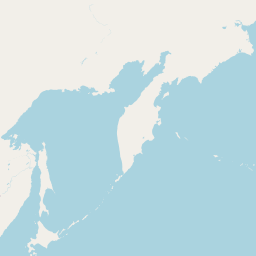
Lima to San Francisco Flight Route Map
Flight map from Lima, Peru to San Francisco, United States is given below.Click the map to view Lima to San Francisco nonstop flight path and travel direction.
                                     Leaflet | © OpenStreetMap The distance between cities calculated based on their latitudes and longitudes. This is also called distance as the crow flies. Bird flight distance is calculated by drawing a straight line between two point coordinates. The length of this drawn line will give the shortest distance value. This distance may be very much different from the actual travel distance. Lima GPS Coordinates: Latitude: S 12° 2' 46.9'' Longitude: W 77° 2' 34.1'' San Francisco GPS Coordinates: Latitude: N 37° 46' 29.7'' Longitude: W 122° 25' 9.9'' Lima Map, Where is Lima located? San Francisco Map, Where is San Francisco located? |
Popular Searches from Lima
- Lima to Miami flight time, duration and distance
- Lima to Honolulu flight time, duration and distance
- Lima to San José flight time, duration and distance
- Lima to Cusco flight time, duration and distance
- Lima to Wellington flight time, duration and distance
- Lima to Miami flight time, duration and distance
- Lima to Mumbai flight time, duration and distance
- Lima to Bogotá flight time, duration and distance
- Lima to Bogotá flight time, duration and distance
- Lima to Los Angeles flight time, duration and distance
- Lima to Panama City flight time, duration and distance
- Lima to Atlanta flight time, duration and distance
- Lima to Iquitos flight time, duration and distance
- Lima to Cusco flight time, duration and distance
- Lima to Kingston flight time, duration and distance
- Lima to Cabo San Lucas flight time, duration and distance
- Lima to Easter Island flight time, duration and distance
- Lima to London flight time, duration and distance
- Lima to Auckland flight time, duration and distance
Popular Searches from San Francisco
- San Francisco to Dallas flight time, duration and distance
- San Francisco to Melbourne flight time, duration and distance
- San Francisco to Las Vegas flight time, duration and distance
- San Francisco to Salt Lake City flight time, duration and distance
- San Francisco to Singapore flight time, duration and distance
- San Francisco to Tokyo flight time, duration and distance
- San Francisco to Anchorage flight time, duration and distance
- San Francisco to Tokyo flight time, duration and distance
- San Francisco to Shanghai flight time, duration and distance
- San Francisco to Chicago flight time, duration and distance
- San Francisco to Bengaluru flight time, duration and distance
- San Francisco to Melbourne flight time, duration and distance
- San Francisco to Portland flight time, duration and distance
- San Francisco to Austin flight time, duration and distance
- San Francisco to Bora-Bora flight time, duration and distance
- San Francisco to Melbourne flight time, duration and distance
- San Francisco to Tehran flight time, duration and distance
- San Francisco to Auckland flight time, duration and distance