New York to Calgary Flight Time, Distance, Route Map
Flight time from New York, United States to Calgary, Canada is 4 hours 3 minutes under avarage conditions. Our flight time calculator assumes an average flight speed for a commercial airliner of 500 mph, which is equivalent to 805 km/hr or 434 knots. Actual flight times may vary depending on aircraft type, cruise speed, routing, weather conditions, passenger load, and other factors.
What is the Flight Distance Between New York and Calgary?
The flight distance from New York (United States) to Calgary (Canada) is 2026 miles. This is equivalent to 3260 kilometers or 1759 nautical miles. The calculated distance (air line) is the straight line distance or direct flight distance between cities. The nearest airport to New York, is La Guardia Airport (LGA) and the nearest airport to Calgary, is Calgary International Airport (YYC).
New York - Calgary Timezones & Time Difference
Current local time in New York is 2025-11-03, 18:59:05 EST
Current local time in Calgary is 2025-11-03, 16:59:05 MST.
Time difference between New York (United States) and Calgary (Canada) is 2 Hours.
Calgary time is 2 Hours behind New York.
New York to Calgary Flight Route Map
Flight map from New York, United States to Calgary, Canada is given below.Click the map to view New York to Calgary nonstop flight path and travel direction.
                  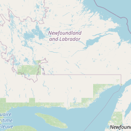   Leaflet | © OpenStreetMap The distance between cities calculated based on their latitudes and longitudes. This is also called distance as the crow flies. Bird flight distance is calculated by drawing a straight line between two point coordinates. The length of this drawn line will give the shortest distance value. This distance may be very much different from the actual travel distance. New York GPS Coordinates: Latitude: N 40° 42' 46'' Longitude: W 74° 0' 21.4'' Calgary GPS Coordinates: Latitude: N 51° 2' 55'' Longitude: W 114° 4' 15'' New York Map, Where is New York located? Calgary Map, Where is Calgary located? |
Popular Searches from New York
- New York to Chicago flight time, duration and distance
- New York to Chicago flight time, duration and distance
- New York to Milwaukee flight time, duration and distance
- New York to Lisbon flight time, duration and distance
- New York to London flight time, duration and distance
- New York to Lisbon flight time, duration and distance
- New York to Sydney flight time, duration and distance
- New York to Detroit flight time, duration and distance
- New York to Philadelphia flight time, duration and distance
- New York to Miami flight time, duration and distance
- New York to London flight time, duration and distance
- New York to Changji Hui Autonomous Prefecture flight time, duration and distance
- New York to Los Angeles flight time, duration and distance
- New York to Orlando flight time, duration and distance
- New York to Sydney flight time, duration and distance
- New York to Laramie flight time, duration and distance
- New York to Brussels flight time, duration and distance
- New York to Doha flight time, duration and distance
Popular Searches from Calgary
- Calgary to Moscow flight time, duration and distance
- Calgary to Québec City flight time, duration and distance
- Calgary to Victoria flight time, duration and distance
- Calgary to San Diego flight time, duration and distance
- Calgary to Playa del Carmen flight time, duration and distance
- Calgary to Tokyo flight time, duration and distance
- Calgary to St. John's flight time, duration and distance
- Calgary to Montreal flight time, duration and distance
- Calgary to Dublin flight time, duration and distance
- Calgary to Cabo San Lucas flight time, duration and distance
- Calgary to Toronto flight time, duration and distance
- Calgary to Guadalajara flight time, duration and distance
- Calgary to Dubai flight time, duration and distance
- Calgary to Singapore flight time, duration and distance
- Calgary to Moscow flight time, duration and distance
- Calgary to Toronto flight time, duration and distance
- Calgary to São Paulo flight time, duration and distance