Palm Springs to Las Vegas Flight Time, Distance, Route Map
Flight time from Palm Springs, United States to Las Vegas, United States is 0 hours 21 minutes under avarage conditions. Our flight time calculator assumes an average flight speed for a commercial airliner of 500 mph, which is equivalent to 805 km/hr or 434 knots. Actual flight times may vary depending on aircraft type, cruise speed, routing, weather conditions, passenger load, and other factors.
What is the Flight Distance Between Palm Springs and Las Vegas?
The flight distance from Palm Springs (United States) to Las Vegas (United States) is 181 miles. This is equivalent to 290 kilometers or 157 nautical miles. The calculated distance (air line) is the straight line distance or direct flight distance between cities. The nearest airport to Palm Springs, is Palm Springs Municipal Airport (PSP) and the nearest airport to Las Vegas, is North Air Terminal (VGT).
Palm Springs - Las Vegas Timezones & Time Difference
Current local time in Palm Springs is 2025-05-10, 22:36:44 PDT
Current local time in Las Vegas is 2025-05-10, 22:36:44 PDT.
Time difference between Palm Springs (United States) and Las Vegas (United States) is 0 Hours.
Palm Springs to Las Vegas Flight Route Map
Flight map from Palm Springs, United States to Las Vegas, United States is given below.Click the map to view Palm Springs to Las Vegas nonstop flight path and travel direction.
  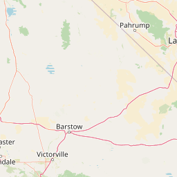 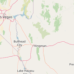 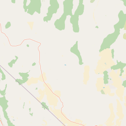 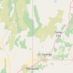 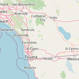             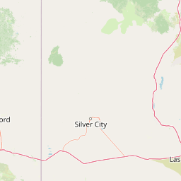  Leaflet | © OpenStreetMap The distance between cities calculated based on their latitudes and longitudes. This is also called distance as the crow flies. Bird flight distance is calculated by drawing a straight line between two point coordinates. The length of this drawn line will give the shortest distance value. This distance may be very much different from the actual travel distance. Palm Springs GPS Coordinates: Latitude: N 33° 49' 49.1'' Longitude: W 116° 32' 43.1'' Las Vegas GPS Coordinates: Latitude: N 36° 10' 11.8'' Longitude: W 115° 8' 23.4'' Palm Springs Map, Where is Palm Springs located? Las Vegas Map, Where is Las Vegas located? |
Popular Searches from Palm Springs
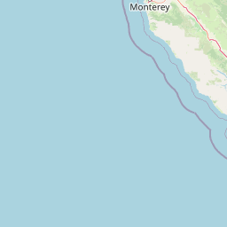
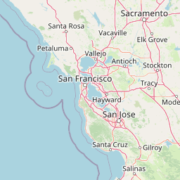
- Palm Springs to San Francisco flight time, duration and distance
- Palm Springs to Phoenix flight time, duration and distance
- Palm Springs to Puerto Vallarta flight time, duration and distance
- Palm Springs to Salt Lake City flight time, duration and distance
- Palm Springs to Minneapolis flight time, duration and distance
- Palm Springs to Denver flight time, duration and distance
- Palm Springs to Hershey flight time, duration and distance
- Palm Springs to Tulsa flight time, duration and distance
- Palm Springs to Nashville flight time, duration and distance
- Palm Springs to Loreto flight time, duration and distance
- Palm Springs to Loreto flight time, duration and distance
- Palm Springs to Loreto flight time, duration and distance
- Palm Springs to San Francisco flight time, duration and distance
- Palm Springs to Dallas flight time, duration and distance
- Palm Springs to Dallas flight time, duration and distance
- Palm Springs to Blue Bell flight time, duration and distance
- Palm Springs to Hilo flight time, duration and distance
- Palm Springs to Blue Bell flight time, duration and distance
- Palm Springs to Hilo flight time, duration and distance
Popular Searches from Las Vegas
- Las Vegas to Melbourne flight time, duration and distance
- Las Vegas to Boa Vista flight time, duration and distance
- Las Vegas to Toronto flight time, duration and distance
- Las Vegas to Miami flight time, duration and distance
- Las Vegas to Chicago flight time, duration and distance
- Las Vegas to Lake Forest flight time, duration and distance
- Las Vegas to Lake Forest flight time, duration and distance
- Las Vegas to Houston flight time, duration and distance
- Las Vegas to San José del Cabo flight time, duration and distance
- Las Vegas to Fresno flight time, duration and distance
- Las Vegas to Honolulu flight time, duration and distance
- Las Vegas to San Francisco flight time, duration and distance
- Las Vegas to Moscow flight time, duration and distance
- Las Vegas to Cabo San Lucas flight time, duration and distance
- Las Vegas to Miami flight time, duration and distance
- Las Vegas to Burbank flight time, duration and distance
- Las Vegas to Raleigh flight time, duration and distance
- Las Vegas to Boise flight time, duration and distance
- Las Vegas to Tokyo flight time, duration and distance