Sydney to Bora-Bora Flight Time, Distance, Route Map
Flight time from Sydney, Australia to Bora-Bora, French Polynesia is 7 hours 26 minutes under avarage conditions. Our flight time calculator assumes an average flight speed for a commercial airliner of 500 mph, which is equivalent to 805 km/hr or 434 knots. Actual flight times may vary depending on aircraft type, cruise speed, routing, weather conditions, passenger load, and other factors.
What is the Flight Distance Between Sydney and Bora-Bora?
The flight distance from Sydney (Australia) to Bora-Bora (French Polynesia) is 3714 miles. This is equivalent to 5977 kilometers or 3226 nautical miles. The calculated distance (air line) is the straight line distance or direct flight distance between cities. The nearest airport to Sydney, is Kingsford Smith Airport (SYD) and the nearest airport to Bora-Bora, is Motu-mute Airport (BOB).
Sydney - Bora-Bora Timezones & Time Difference
Current local time in Sydney is 2025-05-13, 17:29:39 AEST
Current local time in Bora-Bora is 2025-05-12, 21:29:39 -10.
Time difference between Sydney (Australia) and Bora-Bora (French Polynesia) is 20 Hours.
Bora-Bora time is 20 Hours behind Sydney.
Sydney to Bora-Bora Flight Route Map
Flight map from Sydney, Australia to Bora-Bora, French Polynesia is given below.Click the map to view Sydney to Bora-Bora nonstop flight path and travel direction.
    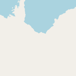   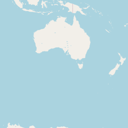      Leaflet | © OpenStreetMap The distance between cities calculated based on their latitudes and longitudes. This is also called distance as the crow flies. Bird flight distance is calculated by drawing a straight line between two point coordinates. The length of this drawn line will give the shortest distance value. This distance may be very much different from the actual travel distance. Sydney GPS Coordinates: Latitude: S 33° 52' 2.9'' Longitude: E 151° 12' 25.1'' Bora-Bora GPS Coordinates: Latitude: S 16° 28' 44.3'' Longitude: W 151° 45' 9.2'' Sydney Map, Where is Sydney located? Bora-Bora Map, Where is Bora-Bora located? |
Popular Searches from Sydney
- Sydney to Dubai flight time, duration and distance
- Sydney to Dubai flight time, duration and distance
- Sydney to Dubai flight time, duration and distance
- Sydney to Doha flight time, duration and distance
- Sydney to Dubai flight time, duration and distance
- Sydney to Dubai flight time, duration and distance
- Sydney to Dubai flight time, duration and distance
- Sydney to London flight time, duration and distance
- Sydney to London flight time, duration and distance
- Sydney to Singapore flight time, duration and distance
- Sydney to Singapore flight time, duration and distance
- Sydney to Manchester flight time, duration and distance
- Sydney to London flight time, duration and distance
- Sydney to London flight time, duration and distance
- Sydney to Singapore flight time, duration and distance
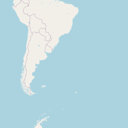
- Sydney to Santiago flight time, duration and distance
- Sydney to Santiago flight time, duration and distance
- Sydney to Abu Dhabi flight time, duration and distance
Popular Searches from Bora-Bora
- Bora-Bora to Lima flight time, duration and distance
- Bora-Bora to Bangkok flight time, duration and distance
- Bora-Bora to San Francisco flight time, duration and distance
- Bora-Bora to Honolulu flight time, duration and distance
- Bora-Bora to San Francisco flight time, duration and distance
- Bora-Bora to Los Angeles flight time, duration and distance
- Bora-Bora to Frankfurt flight time, duration and distance
- Bora-Bora to Corolla flight time, duration and distance
- Bora-Bora to Easter Island flight time, duration and distance
- Bora-Bora to Nassau flight time, duration and distance
- Bora-Bora to Hagåtña flight time, duration and distance
- Bora-Bora to Nassau flight time, duration and distance
- Bora-Bora to Apia flight time, duration and distance
- Bora-Bora to Amman flight time, duration and distance
- Bora-Bora to Honolulu flight time, duration and distance