Toronto to Chicago Flight Time, Distance, Route Map
Flight time from Toronto, Canada to Chicago, United States is 0 hours 52 minutes under avarage conditions. Our flight time calculator assumes an average flight speed for a commercial airliner of 500 mph, which is equivalent to 805 km/hr or 434 knots. Actual flight times may vary depending on aircraft type, cruise speed, routing, weather conditions, passenger load, and other factors.
What is the Flight Distance Between Toronto and Chicago?
The flight distance from Toronto (Canada) to Chicago (United States) is 436 miles. This is equivalent to 702 kilometers or 379 nautical miles. The calculated distance (air line) is the straight line distance or direct flight distance between cities. The nearest airport to Toronto, is Toronto City Centre Airport (YTZ) and the nearest airport to Chicago, is Midway Airport (MDW).
Toronto - Chicago Timezones & Time Difference
Current local time in Toronto is 2025-04-18, 02:38:42 EDT
Current local time in Chicago is 2025-04-18, 01:38:42 CDT.
Time difference between Toronto (Canada) and Chicago (United States) is 1 Hours.
Chicago time is 1 Hours behind Toronto.
Toronto to Chicago Flight Route Map
Flight map from Toronto, Canada to Chicago, United States is given below.Click the map to view Toronto to Chicago nonstop flight path and travel direction.
       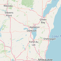         Leaflet | © OpenStreetMap The distance between cities calculated based on their latitudes and longitudes. This is also called distance as the crow flies. Bird flight distance is calculated by drawing a straight line between two point coordinates. The length of this drawn line will give the shortest distance value. This distance may be very much different from the actual travel distance. Toronto GPS Coordinates: Latitude: N 43° 39' 11.6'' Longitude: W 79° 22' 59.5'' Chicago GPS Coordinates: Latitude: N 41° 52' 41.2'' Longitude: W 87° 37' 47.3'' Toronto Map, Where is Toronto located? Chicago Map, Where is Chicago located? |
Popular Searches from Toronto
- Toronto to Singapore flight time, duration and distance
- Toronto to Atlanta flight time, duration and distance
- Toronto to New York flight time, duration and distance
- Toronto to Las Vegas flight time, duration and distance
- Toronto to Newark flight time, duration and distance
- Toronto to Atlanta flight time, duration and distance
- Toronto to Hong Kong flight time, duration and distance
- Toronto to Nice flight time, duration and distance
- Toronto to San Juan flight time, duration and distance
- Toronto to Manila flight time, duration and distance
- Toronto to Nassau flight time, duration and distance
- Toronto to London flight time, duration and distance
- Toronto to Delhi flight time, duration and distance
- Toronto to Bangkok flight time, duration and distance
- Toronto to Honolulu flight time, duration and distance
- Toronto to Cape Town flight time, duration and distance
- Toronto to Naypyidaw flight time, duration and distance
- Toronto to Phnom Penh flight time, duration and distance
- Toronto to New Delhi flight time, duration and distance
- Toronto to Jakarta flight time, duration and distance
Popular Searches from Chicago
- Chicago to Frankfurt am Main flight time, duration and distance
- Chicago to Honolulu flight time, duration and distance
- Chicago to Tijuana flight time, duration and distance
- Chicago to Duhok flight time, duration and distance
- Chicago to London flight time, duration and distance
- Chicago to London flight time, duration and distance
- Chicago to London flight time, duration and distance
- Chicago to Panama City flight time, duration and distance
- Chicago to Porto flight time, duration and distance
- Chicago to Lisbon flight time, duration and distance
- Chicago to Ulaanbaatar flight time, duration and distance
- Chicago to London flight time, duration and distance
- Chicago to Denver flight time, duration and distance
- Chicago to Salt Lake City flight time, duration and distance
- Chicago to Phoenix flight time, duration and distance
- Chicago to Seattle flight time, duration and distance
- Chicago to Grand Rapids flight time, duration and distance
- Chicago to Las Vegas flight time, duration and distance
- Chicago to Tokyo flight time, duration and distance
- Chicago to New York flight time, duration and distance