Addis Ababa to Beijing Flight Time, Distance, Route Map
Flight time from Addis Ababa, Ethiopia to Beijing, China is 10 hours 20 minutes under avarage conditions. Our flight time calculator assumes an average flight speed for a commercial airliner of 500 mph, which is equivalent to 805 km/hr or 434 knots. Actual flight times may vary depending on aircraft type, cruise speed, routing, weather conditions, passenger load, and other factors.
What is the Flight Distance Between Addis Ababa and Beijing?
The flight distance from Addis Ababa (Ethiopia) to Beijing (China) is 5168 miles. This is equivalent to 8317 kilometers or 4488 nautical miles. The calculated distance (air line) is the straight line distance or direct flight distance between cities. The nearest airport to Addis Ababa, is Addis Ababa Bole International Airport (ADD) and the nearest airport to Beijing, is Capital Airport (PEK).
Addis Ababa - Beijing Timezones & Time Difference
Current local time in Addis Ababa is 2025-05-09, 18:12:19 EAT
Current local time in Beijing is 2025-05-09, 23:12:19 CST.
Time difference between Addis Ababa (Ethiopia) and Beijing (China) is 5 Hours.
Beijing time is 5 Hours ahead of Addis Ababa.
Addis Ababa to Beijing Flight Route Map
Flight map from Addis Ababa, Ethiopia to Beijing, China is given below.Click the map to view Addis Ababa to Beijing nonstop flight path and travel direction.
 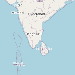      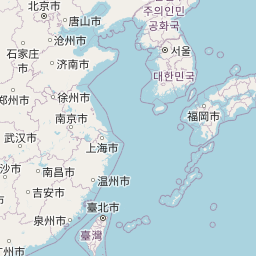    Leaflet | © OpenStreetMap The distance between cities calculated based on their latitudes and longitudes. This is also called distance as the crow flies. Bird flight distance is calculated by drawing a straight line between two point coordinates. The length of this drawn line will give the shortest distance value. This distance may be very much different from the actual travel distance. Addis Ababa GPS Coordinates: Latitude: N 8° 58' 50.2'' Longitude: E 38° 45' 27.9'' Beijing GPS Coordinates: Latitude: N 39° 54' 15.2'' Longitude: E 116° 24' 26.6'' Addis Ababa Map, Where is Addis Ababa located? Beijing Map, Where is Beijing located? |
Popular Searches from Addis Ababa
- Addis Ababa to Cape Town flight time, duration and distance
- Addis Ababa to Rome flight time, duration and distance
- Addis Ababa to Libreville flight time, duration and distance
- Addis Ababa to São Paulo flight time, duration and distance
- Addis Ababa to Cape Town flight time, duration and distance
- Addis Ababa to Toronto flight time, duration and distance
- Addis Ababa to Dubai flight time, duration and distance
- Addis Ababa to Harare flight time, duration and distance
- Addis Ababa to Dakar flight time, duration and distance
- Addis Ababa to Antananarivo flight time, duration and distance
- Addis Ababa to Casablanca flight time, duration and distance
- Addis Ababa to Douala flight time, duration and distance
- Addis Ababa to Nairobi flight time, duration and distance
- Addis Ababa to Tokyo flight time, duration and distance
- Addis Ababa to Sydney flight time, duration and distance
- Addis Ababa to Sydney flight time, duration and distance
- Addis Ababa to Tehran flight time, duration and distance
- Addis Ababa to İstanbul flight time, duration and distance
- Addis Ababa to İstanbul flight time, duration and distance
- Addis Ababa to İstanbul flight time, duration and distance
Popular Searches from Beijing
- Beijing to Washington flight time, duration and distance
- Beijing to Cape Town flight time, duration and distance
- Beijing to Ho Chi Minh City flight time, duration and distance
- Beijing to Sangkat Phnom Penh Thmei flight time, duration and distance
- Beijing to Houston flight time, duration and distance
- Beijing to New York flight time, duration and distance
- Beijing to Wellington flight time, duration and distance
- Beijing to Sentani flight time, duration and distance
- Beijing to Hainan Tibetan Autonomous Prefecture flight time, duration and distance
- Beijing to Auckland flight time, duration and distance
- Beijing to Los Angeles flight time, duration and distance
- Beijing to Rome flight time, duration and distance
- Beijing to Saint Petersburg flight time, duration and distance
- Beijing to Los Angeles flight time, duration and distance
- Beijing to Moscow flight time, duration and distance
- Beijing to Tokyo flight time, duration and distance
- Beijing to Paris flight time, duration and distance
- Beijing to Wellington flight time, duration and distance
- Beijing to Los Angeles flight time, duration and distance
- Beijing to Wellington flight time, duration and distance