Novosibirsk to Sanya Flight Time, Distance, Route Map
Flight time from Novosibirsk, Russia to Sanya, China is 5 hours 48 minutes under avarage conditions. Our flight time calculator assumes an average flight speed for a commercial airliner of 500 mph, which is equivalent to 805 km/hr or 434 knots. Actual flight times may vary depending on aircraft type, cruise speed, routing, weather conditions, passenger load, and other factors.
What is the Flight Distance Between Novosibirsk and Sanya?
The flight distance from Novosibirsk (Russia) to Sanya (China) is 2899 miles. This is equivalent to 4665 kilometers or 2517 nautical miles. The calculated distance (air line) is the straight line distance or direct flight distance between cities. The nearest airport to Novosibirsk, is Tolmachevo Airport (OVB) and the nearest airport to Sanya, is Sanya Airport (SYX).
Novosibirsk - Sanya Timezones & Time Difference
Current local time in Novosibirsk is 2025-05-09, 17:46:46 +07
Current local time in Sanya is 2025-05-09, 18:46:46 CST.
Time difference between Novosibirsk (Russia) and Sanya (China) is 1 Hours.
Sanya time is 1 Hours ahead of Novosibirsk.
Novosibirsk to Sanya Flight Route Map
Flight map from Novosibirsk, Russia to Sanya, China is given below.Click the map to view Novosibirsk to Sanya nonstop flight path and travel direction.
      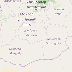      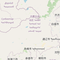                Leaflet | © OpenStreetMap The distance between cities calculated based on their latitudes and longitudes. This is also called distance as the crow flies. Bird flight distance is calculated by drawing a straight line between two point coordinates. The length of this drawn line will give the shortest distance value. This distance may be very much different from the actual travel distance. Novosibirsk GPS Coordinates: Latitude: N 54° 58' 59.8'' Longitude: E 82° 53' 47'' Sanya GPS Coordinates: Latitude: N 18° 15' 10.2'' Longitude: E 109° 30' 42.9'' Novosibirsk Map, Where is Novosibirsk located? Sanya Map, Where is Sanya located? |
Popular Searches from Novosibirsk
- Novosibirsk to Sokhumi flight time, duration and distance
- Novosibirsk to Bangkok flight time, duration and distance
- Novosibirsk to Phuket flight time, duration and distance
- Novosibirsk to Beijing flight time, duration and distance
- Novosibirsk to Beijing flight time, duration and distance
- Novosibirsk to Tomsk flight time, duration and distance
- Novosibirsk to Los Angeles flight time, duration and distance
- Novosibirsk to Atlanta flight time, duration and distance
- Novosibirsk to Colombo flight time, duration and distance
- Novosibirsk to Yakutsk flight time, duration and distance
- Novosibirsk to Baku flight time, duration and distance
- Novosibirsk to Salekhard flight time, duration and distance
- Novosibirsk to Mandalay flight time, duration and distance
- Novosibirsk to Sanya flight time, duration and distance
- Novosibirsk to Domodedovo flight time, duration and distance
- Novosibirsk to Frankfurt flight time, duration and distance
- Novosibirsk to Yoshkar-Ola flight time, duration and distance
- Novosibirsk to Odesa flight time, duration and distance
- Novosibirsk to Prague flight time, duration and distance