Toronto to Keflavík Flight Time, Distance, Route Map
Flight time from Toronto, Canada to Keflavík, Iceland is 5 hours 10 minutes under avarage conditions. Our flight time calculator assumes an average flight speed for a commercial airliner of 500 mph, which is equivalent to 805 km/hr or 434 knots. Actual flight times may vary depending on aircraft type, cruise speed, routing, weather conditions, passenger load, and other factors.
What is the Flight Distance Between Toronto and Keflavík?
The flight distance from Toronto (Canada) to Keflavík (Iceland) is 2587 miles. This is equivalent to 4163 kilometers or 2247 nautical miles. The calculated distance (air line) is the straight line distance or direct flight distance between cities. The nearest airport to Toronto, is Toronto City Centre Airport (YTZ) and the nearest airport to Keflavík, is Keflavik International Airport (KEF).
Toronto - Keflavík Timezones & Time Difference
Current local time in Toronto is 2025-03-29, 12:54:03 EDT
Current local time in Keflavík is 2025-03-29, 16:54:03 GMT.
Time difference between Toronto (Canada) and Keflavík (Iceland) is 4 Hours.
Keflavík time is 4 Hours ahead of Toronto.
Toronto to Keflavík Flight Route Map
Flight map from Toronto, Canada to Keflavík, Iceland is given below.Click the map to view Toronto to Keflavík nonstop flight path and travel direction.
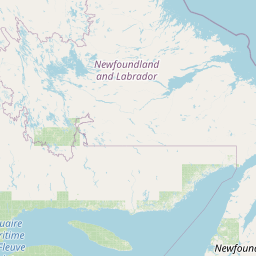          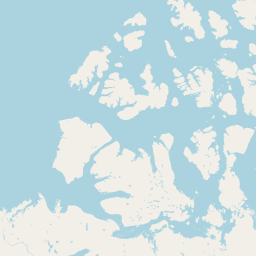 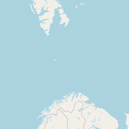      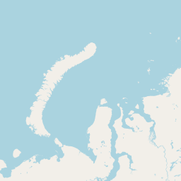    Leaflet | © OpenStreetMap The distance between cities calculated based on their latitudes and longitudes. This is also called distance as the crow flies. Bird flight distance is calculated by drawing a straight line between two point coordinates. The length of this drawn line will give the shortest distance value. This distance may be very much different from the actual travel distance. Toronto GPS Coordinates: Latitude: N 43° 39' 11.6'' Longitude: W 79° 22' 59.5'' Keflavík GPS Coordinates: Latitude: N 63° 59' 59.1'' Longitude: W 22° 33' 29.8'' Toronto Map, Where is Toronto located? Keflavík Map, Where is Keflavík located? |
Popular Searches from Toronto
- Toronto to Nassau flight time, duration and distance
- Toronto to London flight time, duration and distance
- Toronto to Delhi flight time, duration and distance
- Toronto to Bangkok flight time, duration and distance
- Toronto to Honolulu flight time, duration and distance
- Toronto to Cape Town flight time, duration and distance
- Toronto to Naypyidaw flight time, duration and distance
- Toronto to Phnom Penh flight time, duration and distance
- Toronto to New Delhi flight time, duration and distance
- Toronto to Jakarta flight time, duration and distance
- Toronto to Bangkok flight time, duration and distance
- Toronto to Seoul flight time, duration and distance
- Toronto to Mexico City flight time, duration and distance
- Toronto to Phuket flight time, duration and distance
- Toronto to Chicago flight time, duration and distance
- Toronto to Bangkok flight time, duration and distance
- Toronto to Bangkok flight time, duration and distance
- Toronto to Bangkok flight time, duration and distance
- Toronto to Beijing flight time, duration and distance
- Toronto to Beijing flight time, duration and distance
Popular Searches from Keflavík
- Keflavík to Helsinki flight time, duration and distance
- Keflavík to Dundee flight time, duration and distance
- Keflavík to Raleigh flight time, duration and distance
- Keflavík to Dar es Salaam flight time, duration and distance
- Keflavík to Copenhagen flight time, duration and distance
- Keflavík to Frankfurt flight time, duration and distance
- Keflavík to Antalya flight time, duration and distance
- Keflavík to Calgary flight time, duration and distance
- Keflavík to Edmonton flight time, duration and distance
- Keflavík to Chicago flight time, duration and distance
- Keflavík to Waterford flight time, duration and distance
- Keflavík to Munich flight time, duration and distance
- Keflavík to Portland flight time, duration and distance
- Keflavík to Calgary flight time, duration and distance
- Keflavík to Paris flight time, duration and distance
- Keflavík to Portland flight time, duration and distance
- Keflavík to San Francisco flight time, duration and distance
- Keflavík to Santa Cruz de Tenerife flight time, duration and distance
- Keflavík to London flight time, duration and distance