Delhi to Amsterdam Flight Time, Distance, Route Map
Flight time from Delhi, India to Amsterdam, Netherlands is 7 hours 54 minutes under avarage conditions. Our flight time calculator assumes an average flight speed for a commercial airliner of 500 mph, which is equivalent to 805 km/hr or 434 knots. Actual flight times may vary depending on aircraft type, cruise speed, routing, weather conditions, passenger load, and other factors.
What is the Flight Distance Between Delhi and Amsterdam?
The flight distance from Delhi (India) to Amsterdam (Netherlands) is 3949 miles. This is equivalent to 6355 kilometers or 3429 nautical miles. The calculated distance (air line) is the straight line distance or direct flight distance between cities. The nearest airport to Delhi, is Indira Gandhi International Airport (DEL) and the nearest airport to Amsterdam, is Amsterdam-Schiphol Airport (AMS).
Delhi - Amsterdam Timezones & Time Difference
Current local time in Delhi is 2025-03-15, 06:06:02 IST
Current local time in Amsterdam is 2025-03-15, 01:36:02 CET.
Time difference between Delhi (India) and Amsterdam (Netherlands) is 4 Hours 30 Minutes.
Amsterdam time is 4 Hours 30 Minutes behind Delhi.
Delhi to Amsterdam Flight Route Map
Flight map from Delhi, India to Amsterdam, Netherlands is given below.Click the map to view Delhi to Amsterdam nonstop flight path and travel direction.
         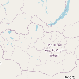    Leaflet | © OpenStreetMap The distance between cities calculated based on their latitudes and longitudes. This is also called distance as the crow flies. Bird flight distance is calculated by drawing a straight line between two point coordinates. The length of this drawn line will give the shortest distance value. This distance may be very much different from the actual travel distance. Delhi GPS Coordinates: Latitude: N 28° 39' 42.8'' Longitude: E 77° 13' 38.6'' Amsterdam GPS Coordinates: Latitude: N 52° 22' 12.8'' Longitude: E 4° 53' 42.6'' Delhi Map, Where is Delhi located? Amsterdam Map, Where is Amsterdam located? |
Popular Searches from Delhi
- Delhi to New York flight time, duration and distance
- Delhi to Wellington flight time, duration and distance
- Delhi to Mumbai flight time, duration and distance
- Delhi to Toronto flight time, duration and distance
- Delhi to Pune flight time, duration and distance
- Delhi to Tokyo flight time, duration and distance
- Delhi to Varanasi flight time, duration and distance
- Delhi to Toronto flight time, duration and distance
- Delhi to Singapore flight time, duration and distance
- Delhi to New York flight time, duration and distance
- Delhi to Dubai flight time, duration and distance
- Delhi to Dhaka flight time, duration and distance
- Delhi to Kolkata flight time, duration and distance
- Delhi to Udaipur flight time, duration and distance
- Delhi to Vadodara flight time, duration and distance
- Delhi to Amsterdam flight time, duration and distance
- Delhi to Ahmedabad flight time, duration and distance
- Delhi to Darbhanga flight time, duration and distance
- Delhi to Toronto flight time, duration and distance
- Delhi to Los Angeles flight time, duration and distance
Popular Searches from Amsterdam
- Amsterdam to Uzbekistan flight time, duration and distance
- Amsterdam to Toronto flight time, duration and distance
- Amsterdam to Mumbai flight time, duration and distance
- Amsterdam to Barcelona flight time, duration and distance
- Amsterdam to Palermo flight time, duration and distance
- Amsterdam to New York flight time, duration and distance
- Amsterdam to Busuanga flight time, duration and distance
- Amsterdam to Boston flight time, duration and distance
- Amsterdam to New York flight time, duration and distance
- Amsterdam to Detroit flight time, duration and distance
- Amsterdam to Hong Kong flight time, duration and distance
- Amsterdam to Seattle flight time, duration and distance
- Amsterdam to Seattle flight time, duration and distance
- Amsterdam to Brussels flight time, duration and distance
- Amsterdam to Milan flight time, duration and distance
- Amsterdam to Singapore flight time, duration and distance
- Amsterdam to Manchester flight time, duration and distance
- Amsterdam to Strasbourg flight time, duration and distance